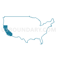
Los Angeles County (South)--South Gate & Lynwood Cities PUMA, California
About
Outline
--South+Gate+%26+Lynwood+Cities+PUMA%2c+California_A280.png)
Summary
| Unique Area Identifier | 192380 |
| Name | Los Angeles County (South)--South Gate & Lynwood Cities PUMA |
| State | California |
| Area (square miles) | 12.72 |
| Land Area (square miles) | 12.53 |
| Water Area (square miles) | 0.19 |
| % of Land Area | 98.52 |
| % of Water Area | 1.48 |
| Latitude of the Internal Point | 33.93678560 |
| Longtitude of the Internal Point | -118.19681620 |
Maps
Graphs
Select a template below for downloading or customizing gragh for Los Angeles County (South)--South Gate & Lynwood Cities PUMA, California
--South+Gate+%26+Lynwood+Cities+PUMA%2c+California_T0.png)
--South+Gate+%26+Lynwood+Cities+PUMA%2c+California_T1.png)
--South+Gate+%26+Lynwood+Cities+PUMA%2c+California_T2.png)
--South+Gate+%26+Lynwood+Cities+PUMA%2c+California_T3.png)
--South+Gate+%26+Lynwood+Cities+PUMA%2c+California_T4.png)
--South+Gate+%26+Lynwood+Cities+PUMA%2c+California_T5.png)
--South+Gate+%26+Lynwood+Cities+PUMA%2c+California_T6.png)
--South+Gate+%26+Lynwood+Cities+PUMA%2c+California_T7.png)
Neighbors
Neighoring Public Use Microdata Area (by Name) Neighboring Public Use Microdata Area on the Map
- Los Angeles County (Central)--Bell Gardens, Bell, Maywood, Cudahy & Commerce Cities PUMA, CA
- Los Angeles County (Central)--Huntington Park City, Florence-Graham & Walnut Park PUMA, CA
- Los Angeles County (South Central)--Compton City & West Rancho Dominguez PUMA, CA
- Los Angeles County (South Central)--LA City (South Central/Watts) PUMA, CA
- Los Angeles County (South)--Downey City PUMA, CA
- Los Angeles County (Southeast)--Bellflower & Paramount Cities PUMA, CA
Top 10 Neighboring County (by Population) Neighboring County on the Map
Top 10 Neighboring County Subdivision (by Population) Neighboring County Subdivision on the Map
- Los Angeles CCD, Los Angeles County, CA (2,504,251)
- South Gate-East Los Angeles CCD, Los Angeles County, CA (501,237)
- Downey-Norwalk CCD, Los Angeles County, CA (414,144)
- Compton CCD, Los Angeles County, CA (342,576)
Top 10 Neighboring Place (by Population) Neighboring Place on the Map
- Los Angeles city, CA (3,792,621)
- Downey city, CA (111,772)
- Compton city, CA (96,455)
- South Gate city, CA (94,396)
- Lynwood city, CA (69,772)
- Florence-Graham CDP, CA (63,387)
- Huntington Park city, CA (58,114)
- Paramount city, CA (54,098)
- Bell Gardens city, CA (42,072)
- Willowbrook CDP, CA (35,983)
Top 10 Neighboring Unified School District (by Population) Neighboring Unified School District on the Map
- Los Angeles Unified School District, CA (4,541,134)
- Compton Unified School District, CA (154,769)
- Downey Unified School District, CA (120,994)
- Paramount Unified School District, CA (77,645)
- Lynwood Unified School District, CA (68,397)
Top 10 Neighboring State Legislative District Lower Chamber (by Population) Neighboring State Legislative District Lower Chamber on the Map
- Assembly District 52, CA (451,939)
- Assembly District 46, CA (430,224)
- Assembly District 58, CA (429,216)
- Assembly District 50, CA (422,607)
Top 10 Neighboring State Legislative District Upper Chamber (by Population) Neighboring State Legislative District Upper Chamber on the Map
- State Senate District 25, CA (860,352)
- State Senate District 27, CA (857,163)
- State Senate District 30, CA (848,551)
- State Senate District 22, CA (843,734)
Top 10 Neighboring 111th Congressional District (by Population) Neighboring 111th Congressional District on the Map
- Congressional District 35, CA (662,413)
- Congressional District 34, CA (654,303)
- Congressional District 37, CA (648,847)
- Congressional District 39, CA (643,115)
Top 10 Neighboring Census Tract (by Population) Neighboring Census Tract on the Map
- Census Tract 5362, Los Angeles County, CA (7,289)
- Census Tract 5508, Los Angeles County, CA (7,170)
- Census Tract 5400, Los Angeles County, CA (6,973)
- Census Tract 5401.02, Los Angeles County, CA (6,972)
- Census Tract 5405.01, Los Angeles County, CA (6,943)
- Census Tract 5402.02, Los Angeles County, CA (6,845)
- Census Tract 5358.02, Los Angeles County, CA (6,814)
- Census Tract 2430, Los Angeles County, CA (6,769)
- Census Tract 5349, Los Angeles County, CA (6,569)
- Census Tract 5405.02, Los Angeles County, CA (6,552)
Top 10 Neighboring 5-Digit ZIP Code Tabulation Area (by Population) Neighboring 5-Digit ZIP Code Tabulation Area on the Map
- 90201, CA (101,279)
- 90280, CA (94,396)
- 90255, CA (75,066)
- 90262, CA (69,745)
- 90001, CA (57,110)
- 90723, CA (54,099)
- 90221, CA (53,704)
- 90002, CA (51,223)
- 90242, CA (43,497)
- 90241, CA (42,399)


--South+Gate+%26+Lynwood+Cities+PUMA in California.png)

--South+Gate+%26+Lynwood+Cities+PUMA%2c+California.png)